

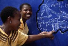
Geographic Approaches to Global Health
It is important to harness geography to manage, analyze, and leverage spatial data effectively when planning, monitoring, and evaluating health sector programs. Through this course, learners will gain an understanding of how to use spatial data to enhance the decision-making process for health program implementation in limited resource settings.
Objective
By the end of this course, the learner will - within a public health context - be able to:
- Understand the basics of spatial data and its role in decision making
- Explain why geographic data and tools are important for decision makers
- Understand geography as a unifying framework and GIS as a tool to collect, link, analyze, visualize, manage, and share data and information
- Address the challenges and explore the opportunities of working with spatial data to produce geographic information and geographically based knowledge
- Distinguish between the different tools used to collect, analyze, and manipulate geographic data
- Communicate with technical specialists to develop program-specific geographic products
Credits
Collaborating organizations involved in the development of Geographic Approaches to Global Health include:
- Taiwo Abimbola, Centers for Disease Control and Prevention
- Maria Au, United States Agency for International Development
- Rachel Blacher, ICF Macro
- Carlos Castillo-Salgado, Johns Hopkins University School for Public Health
- Steeve Ebener, World Health Organization
- Nate Heard, Humanitarian Information Unit, United States Department of State
- Mary Kratz, United States Department of Defense
- Libby Skolnik, Johns Hopkins University Center for Communication Programs
- John Spencer, MEASURE Evaluation
- James Stewart, MEASURE Evaluation
- Becky Wilkes, MEASURE Evaluation
We would like to acknowledge and thank the following experts for reviewing the course:
- Maria Au, USAID
- Shabani CISHAHAYO, TRAC Plus, Rwanda
- Mike Emch, Department of Geography, UNC-Chapel Hill
- Sabri GMACH, Regional Office of Public Health, Bizerte, Tunisia
- Eric Green, NYU/Population Council
- Janet Heitgard, CDC
- Carl Kinkade, CDC
- Jorge Luna, Mailman School of Public Health, Columbia University
- Michelle Monroe, US Department of State, Malawi
- Patrick NAPHINI, Ministry of Health, Malawi
- Adama NDIR, Ministry of Health and Prevention, Senegal
- Greg Russell, OGAC
- Virginia SIMUSHI, Zambia
- Hilary Spindler, UCSF Global Health Institute
For general inquiries about the Geographic Approaches to Global Health, please email MEASURE Evaluation by clicking here.

 In this section, you can provide feedback about this course to help us make NextGenU.org better. Once evaluations are completed, you will be able to download your certificate of completion.